Development of Wind Power Projects in Albania -Wind Siting Study
This study analysis of Albanian territory aimed to find potentially suitable areas to develop new Wind Projects. A Geographic Information System (GIS) was implemented to collect and manage relevant data describing physical, biological and social features that characterize the Country.
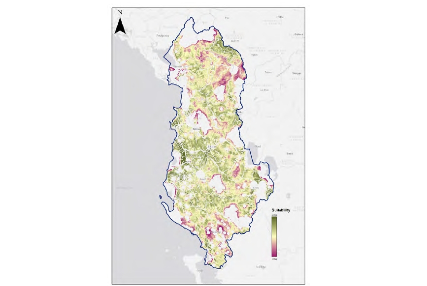
The methodology consisted in a Multi-Criteria Decision Analysis (MCDA), based on GIS data, used to develop spatial criteria to support the decision-making process for the identification of the most suitable areas for new Wind Projects.
This study will be subject to periodic review and update. The criteria chosen for determining the suitability of areas for wind projects reflect policy choices at the date of publication.
The criteria identified as either constraints or no-go areas (to identify exclusions) or indicators (to characterize a higher or lower suitability) were implemented in response to a series of sustainability goals. The criteria were grouped into three sustainability dimensions, Environmental, Social and Technical, and weighted based on their relative importance, according to a consultation process with stakeholders.
The application of the proprietary GoldSET Spatial tool allowed to combine criteria and weights to produce a Suitability map. The final step was to analyse the suitability map and to identify large areas, presenting the higher values of suitability.